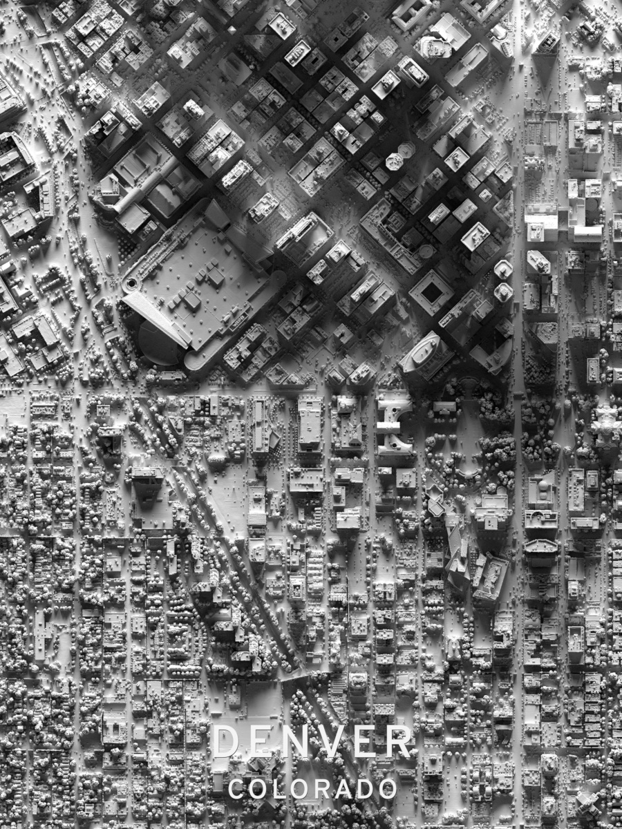
I am reluctant to be commercial on a mailing list so dedicated to openness, so feel free to ignore or delete if I go too far. I just dropped a set of art prints today made using Radiance that I think some of you might appreciate. They are 3D rendered maps of cities and ski resorts made from LiDAR data, and >20 years on this group getting help with Radiance made them possible. Here’s an excerpt from Denver. If you enjoy these, drop a few “likes” on the site. I take recommendations, too! https://society6.com/summerstreet
1 Like
FYI, the geometry for each scene is 80-200M triangles, broken into up to 100-400 rtm files, plus a few more for the large area lights and the text. Each image is rendered on a 16-core Zen2 machine at 18000x24000 (using -ab 3 -aa 0 -ad 16 -as 16) and takes about 5-6 hours, tracing 1/2 trillion rays. The images are designed to look uncannily realistic when placed on a wall with a general or spot overhead light. I’ve had to reach out and touch them to remember that they are not actually 3D.
Wow is all I can say.
Thank you is all I can say.
Yet another amazing project with Radiance, Mark! I love this.
That is just incredible. What a wonderful use case!